Место работы автора, адрес/электронная почта: Max-Planck-Gesellschaft ; Kahlaische Strasse, 1007745, Jena, GERMANY ; e-mail: boxleitner@gea.mpg.de ; https://www.gea.mpg.de/2944/en
Область научных интересов: Палеоэкология, палеоэтноботаника, Центральная и Северо-Восточная Азия
Количество страниц: 24 с.
На основе остатков ископаемых организмов, включая макрофоссилии растений, древесный уголь, пыльцу и беспозвоночных, сохранившихся в сингенетических отложениях Батагайской мерзлотной толщи Сибирско-Янского нагорья, мы реконструировали историю окружающей среды в течение морских изотопных стадий (MIS) 6-2. Две ископаемые коллекции, исключительно богатые растительными остатками, позволили детально описать палеорастительность во время двух климатических экстремумов позднего плейстоцена - наступления последнего ледникового максимума (LGM) и последнего межледниковья. Кроме того, всего 41 коллекция была использована для описания истории растительности с предпоследнего холодного этапа MIS 6. Соответственно, луговые степи, аналогичные современным сообществам фитосоциологического порядка Festucetalia lenensis, формировали основную растительность во время саальского и вейхзельского холодных этапов. Холодостойкие тундрово-степные сообщества (Caricirupestris-Kobresietea bellardii) в том виде, в котором они встречаются сегодня выше линии леса, в отличие от более северных районов, в основном отсутствовали. Во время последнего межледниковья основной растительностью на участке были открытые хвойные леса, похожие на современную лиственничную тайгу. Обилие древесного угля указывает на лесные пожары во время последнего межледниковья. Следовательно, луговые степи существовали на Янской возвышенности на протяжении всего исследуемого периода от МИС 6 до МИС 2, что свидетельствует об удивительной экологической стабильности. Таким образом, доля луговой степной растительности просто менялась в зависимости от преобладающих климатических условий. Их сохранение свидетельствует о низком количестве осадков и относительно теплом вегетационном периоде на протяжении всего позднего плейстоцена и после него. Изученная ископаемая летопись также доказывает, что современные степи на Янской возвышенности возникли не позднее голоцена, а являются реликтами ранее непрерывного степного пояса, простиравшегося в плейстоцене от Центральной Сибири до Северо-Восточной Якутии. Сохранение растений и беспозвоночных, характерных для растительности луговых степей во внутренней Якутии на протяжении позднего четвертичного периода, указывает на климатическую непрерывность и подтверждает пригодность этого региона в качестве арефугиума и для других организмов плейстоценовой мамонтовой степи, включая знаковых крупных травоядных
Woodlands and steppes: Pleistocene vegetation in Yakutia's most continental part recorded in the Batagay permafrost sequence / K. Ashastina, S. Kuzmina, N. Rudaya [etc.] // Quaternary International. - 2018. - Volume 196. - P. 38-61. URL: https://www.sciencedirect.com/science/article/abs/pii/S0277379118300672?via%3Dihub (дата обращения: 29.10.2024). - References: p. 58-61 (117 titles).
DOI: 10.1016/j.quascirev.2018.07.032
Количество страниц: 18 с.
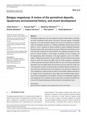
Батагайский провал, расположенный на Янской возвышенности в северной Якутии, Россия, является крупнейшим известным регрессивно-талым оползнем в мире. Просадка обнажает значительную последовательность мерзлотных отложений ледникового периода, которые отражают взаимодействие коллювиальных, эоловых и перигляциальных процессов на склоне холма, эпизодически покрывавшемся лесом в течение последних 650 тыс. лет назад или более в ответ на изменчивость климата на ледниково-межледниковом временном интервале. Из вечной мерзлоты были извлечены многочисленные кости, зубы и отдельные туши плейстоценовых и голоценовых млекопитающих. Оползень развивался в течение нескольких десятилетий в три этапа: (1) образование оврага, (2) проседание почвы при таянии и (3) провал. После нарушения растительного покрова тайги в 1940-1960-х гг. к началу 1960-х годов образовался овраг на склоне холма. Овраг инициировал оползень вдоль его центральной части в 1980-х годах, а затем оползень увеличился до огромного провала (>20 га) в 1990-х годах. К 2019 году площадь оползня достигла около 80 га, а высота его бровки над дном оползня - около 55 м. Основными геоморфологическими процессами роста оползня являются абляция стенки и термическая эрозия, в результате чего на дне оползня образуется характерный рельеф ледяных бэдлендов. Хотя в настоящее время большая часть провала быстро растет, со временем он, вероятно, стабилизируется как неравномерный рельеф, характеризующийся песчаными хребтами и заполненными песком удлиненными впадинами, образовавшимися в результате деградации бэдлендов. Сравнение Батагайского провалаа с провалами северо-западной Канады выявило ряд сходств и различий в геоморфологии, отложениях вечной мерзлоты и Четвертичной истории
Batagay megaslump: A review of the permafrost deposits, Quaternary environmental history, and recent development / Julian Murton, Thomas Opel, Sebastian Wetterich [etc.] // Wiley. Online library. - 2023. - Volume 34(Issue 3). - P. 399-416. URL: https://onlinelibrary.wiley.com/doi/10.1002/ppp.2194 (дата обращения: 29.10.2024).
DOI: 10.1002/ppp.2194

