Количество страниц: 4 с.
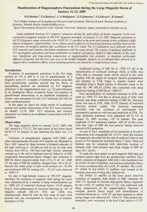
Manifestation of Magnetosphere Fluctuations during the Large Magnetic Storm of January 21-22, 2005 / D. G. Baishev, E. S. Barkova, V. A. Mullayarov, S. N. Samsonov, S. I. Solovyev, K. Yumoto // Solar Extreme Events Fundamental Science and Applied Aspects Nor-Amberd, Armenia 26-30 September 2005 : proceedings of the Second International Symposium / edited by A. Chilingarian and G. Karapetyan. − Erevan : Cosmic Ray Division, Alikhanyan Physics Institute, 2006. − P. 96-99.
Количество страниц: 4 с.
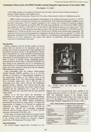
Baishev, D. G. Undulations Observed by the DMSP Satellites during Magnetic Superstorms of November 2004 / D. G. Baishev, F. J. Rich // Solar Extreme Events Fundamental Science and Applied Aspects Nor-Amberd, Armenia 26-30 September 2005 : proceedings of the Second International Symposium / edited by A. Chilingarian and G. Karapetyan. − Erevan : Cosmic Ray Division, Alikhanyan Physics Institute, 2006. − P. 100-103.
Количество страниц: 2 с.
- Математика. Естественные науки > Астрономия. Астрофизика. Исследование космического пространства. Геодезия,
- Математика. Естественные науки > Геология. Геологические и геофизические науки,
- НАУКА ЯКУТИИ > МАТЕМАТИКА. ЕСТЕСТВЕННЫЕ НАУКИ > Астрономия. Астрофизика. Исследование космического пространства. Геодезия,
- НАУКА ЯКУТИИ > МАТЕМАТИКА. ЕСТЕСТВЕННЫЕ НАУКИ > Геология. Геологические и геофизические науки.
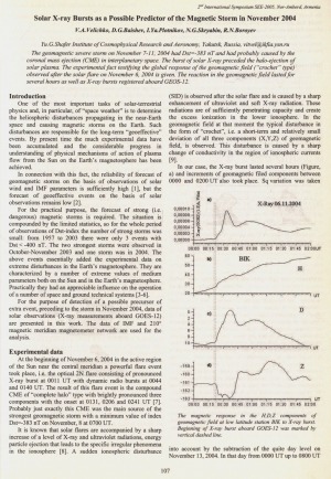
Solar X-ray Bursts as a Possible Predictor of the Magnetic Storm in November 2004 / V. A. Velichko, D. G. Baishev, I. Ya. Plotnikov, N. G. Skryabin, R. N. Boroev // Solar Extreme Events Fundamental Science and Applied Aspects Nor-Amberd, Armenia 26-30 September 2005 : proceedings of the Second International Symposium / edited by A. Chilingarian and G. Karapetyan. − Erevan : Cosmic Ray Division, Alikhanyan Physics Institute, 2006. − P. 107-108.
Количество страниц: 22 с.
- Математика. Естественные науки > Астрономия. Астрофизика. Исследование космического пространства. Геодезия,
- Математика. Естественные науки > Геология. Геологические и геофизические науки,
- НАУКА ЯКУТИИ > МАТЕМАТИКА. ЕСТЕСТВЕННЫЕ НАУКИ > Астрономия. Астрофизика. Исследование космического пространства. Геодезия,
- НАУКА ЯКУТИИ > МАТЕМАТИКА. ЕСТЕСТВЕННЫЕ НАУКИ > Геология. Геологические и геофизические науки.
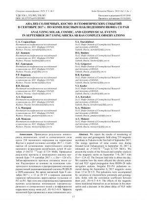
We report the results of monitoring of cosmic rays and geomagnetic field along 210 magnetic meridians in Yakutia in the first half of September 2017. The energy spectrum of solar cosmic rays during Ground Level Enhancement in September 10, 2017 is estimated as J=3027E–1.99exp(–E/729 MeV). We present the results of the forecast and complex analysis of the magnetic storm on September 7–9, 2017 with Dst=–124 nT. The forecast lead time is about one day. We examine how the storm affected the electric poten-tial and VLF signal propagation from RSDN-20 radio navigation stations. Irregular Pi3–Pi1 pulsations oc-curred during the September 8, 2017 magnetic storm from 12 to 20 UT. The pulsations were accompanied by variations in electrotelluric potentials and geomag-netic fields with the correlation coefficient between them ρ(E, H)=0.5÷0.9. The effects of the magnetic storm manifested themselves as an increase in the atten-uation and a decrease in the phase delay of VLF radio signals.
Анализ солнечных, космо- и геофизических событий в сентябре 2017 г. по комплексным наблюдениям ИКФИА СО РАН / С. А. Стародубцев, Д. Г. Баишев, В. Г. Григорьев, Р. Р. Каримов, В. И. Козлов, А. А. Корсаков, Г. А. Макаров, А. В. Моисеев // Солнечно-земная физика = Solar-Terrestrial Physics. – 2019. – Т. 5, N 1. – С. 17-38. – DOI: 10.12737/szf-51201903.
DOI: 10.12737/szf-51201903
Количество страниц: 10 с.
- Общественные науки. Образование > Экономика. Экономические науки. Политическая экономия,
- Математика. Естественные науки > Геология. Геологические и геофизические науки,
- НАУКА ЯКУТИИ > ОБЩЕСТВЕННЫЕ НАУКИ > Экономика. Экономические науки. Политическая экономия,
- НАУКА ЯКУТИИ > МАТЕМАТИКА. ЕСТЕСТВЕННЫЕ НАУКИ > Геология. Геологические и геофизические науки.
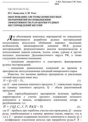
To justify a set of measures to increase the efficiency of mining ore deposits, we used the results of a generalization of world trends, features, patterns of development of SMEs of ore deposits, a retrospective analysis of the reproduction and use of reserves of diamonds, gold, tin, antimony and other minerals of the Far Eastern District of the Russian Federation.
Обоснование системы комплексных мероприятий по повышении эффективности разработки рудных месторождений Якутии / Н. С. Батугина, С. М. Ткач . – Текст : непосредственный // Горный информационно-аналитический бюллетень. – 2010. – N S4. – C. 115-124.
Количество страниц: 2 с.
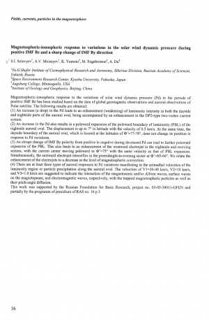
Magnetospheric-ionospheric response to variations in the solar wind dynamic pressure during positive IMF Bz and a sharp change of IMF By direction : [тезисы докладов] / S. I. Solovyev, A. V. Moiseyev, K. Yumoto, M. Engebretson, A. Du // Physics of auroral phenomena : 29th annual seminar, 27 February – 3 March 2006 : abstracts. – 2006. – P. 36.
Количество страниц: 6 с.
- Математика. Естественные науки > Геология. Геологические и геофизические науки,
- Прикладные науки. Медицина. Ветеринария. Техника. Сельское хозяйство > Инженерное дело. Техника в целом > Горное дело. Горные предприятия (рудники, шахты, карьеры),
- НАУКА ЯКУТИИ > МАТЕМАТИКА. ЕСТЕСТВЕННЫЕ НАУКИ > Геология. Геологические и геофизические науки,
- НАУКА ЯКУТИИ > ПРИКЛАДНЫЕ НАУКИ. МЕДИЦИНА. ТЕХНИКА. СЕЛЬСКОЕ ХОЗЯЙСТВО > Инженерное дело. Техника в целом > Горное дело. Горные предприятия (рудники, шахты, карьеры).
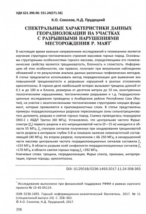
At present, an important area of research in geomechanics is the study of the structural-tectonic structure of rock massifs. The main structural features of the rock mass, determining its geomechanical properties are fracture, blockiness and stratification. Information on these features, as a rule, is obtained by visual observation of outcrops and by analysis of data from various geophysical methods. In the article, it is proposed to use the georadiolocation method to identify zones of increased fracturing and discontinuous disturbances in loose cryolithozone deposits. In mining, the greatest interest is caused by cracks with a length of 0.1 m to 100 m and blocks ranging in size from tens of meters to 10 km, delineated by geological disturbances, tectonic ruptures, etc. Georadar tracking studies were conducted in the Anabar region of the Republic of Sakha (Yakutia), on a site with numerous tectonic structures that cut the foundation, which appear in the near-surface layers. The article presents examples of georadiolocation cross sections of highly fractured dolomite, rupture and crushing of rocks. The survey was carried out by georadar OKO-2 with ABDL Triton (60 MHz). It is established that the central frequency of the Fourier spectrum ( f c) of the first section and its non-fracturable part (0-15 m) is in the region of 55 MHz. f c of the signal spectra obtained during the probing of the fractured part of the section in the depth interval of 5-8 m showed the presence of a low-frequency component (40 MHz). In the second section, obtained with AB 250 MHz, in the undisturbed part of the array, the central frequency of georadar tracking signals was f c = 233 MHz. In the region of discontinuity of the axes of in-phase georadar locating signals, f c = 170 MHz, in the crushing region of rocks, f c = 292 MHz.
Спектральные характеристики данных георадиолокации на участках с разрывными нарушениями месторождения р. Маят / К. О. Соколов, Н. Д. Прудецкий // Горный информационно-аналитический бюллетень. – 2017. – N S24: Материалы IV Всероссийской научно-практической конференции, посвященной памяти чл.-корр. РАН М. Д. Новопашина "Геомеханические и геотехнологические проблемы эффективного освоения месторождений твердых полезных ископаемых Северных и Северо-Восточных регионов России" (г. Якутск, 18-21 сентября 2017 г.). – C. 358-363.
Количество страниц: 10 с.
- Математика. Естественные науки > Геология. Геологические и геофизические науки,
- Прикладные науки. Медицина. Ветеринария. Техника. Сельское хозяйство > Инженерное дело. Техника в целом > Горное дело. Горные предприятия (рудники, шахты, карьеры),
- НАУКА ЯКУТИИ > МАТЕМАТИКА. ЕСТЕСТВЕННЫЕ НАУКИ > Геология. Геологические и геофизические науки,
- НАУКА ЯКУТИИ > ПРИКЛАДНЫЕ НАУКИ. МЕДИЦИНА. ТЕХНИКА. СЕЛЬСКОЕ ХОЗЯЙСТВО > Инженерное дело. Техника в целом > Горное дело. Горные предприятия (рудники, шахты, карьеры).
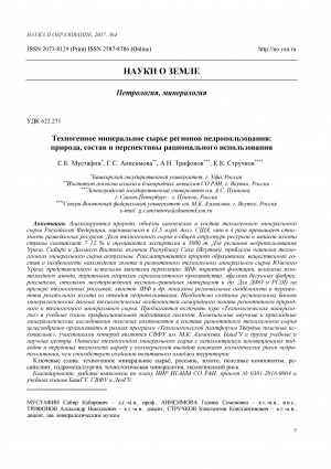
The nature, volumes of accumulation and composition of technogenic mineral raw materials of the Russian Federation estimated in 43,5 billion US dollars, that in 4 times exceeds cost of the reconnoitered resources are analyzed. The share of technogenic raw materials in the general structure of resources and gold reserves of the country is 7-12% and is estimated by experts at 5,000 tonnes. For subsoil use regions of the Urals, Siberia and the Far East, including the Republic of Sakha (Yakutia), the problems of developing technogenic mineral raw materials are relevant. The nature of formation, material composition and peculiarities of finding gold in various types of technogenic mineral raw materials of the Southern Urals are considered. The raw materials are presented by the tailings of percolation of the mill, pyrite flotation, slags of the goldmine plant, pyritic cinder of sulfuric acid production, ephems of runner factories, placers, screenings of sand and gravel deposits, etc. For the Far Eastern Federal District and the RS (Y), regional examples and prospects for recycling gold from waste subsoil are shown on the example of technogenic placers, tailings of the mill, etc. It is necessary to create regional banks of mineralogical data of technological features of native gold of various types of natural and technogenic mineral raw materials. It is proposed to include the course ҺTechnological Mineralogyһ in the curricula of vocational training of geologists. Complex scientific and applied mineralogical research of useful components in the composition of diverse types of technogenic raw materials is expedient for organizing within the framework of programs of the ҺTechnological Platform Solid Mineralsһ in which the NEFU named after M.K. Ammosov, Bashkir State University and other educational and scientific centers are members. The development of technogenic mineral raw materials with the use of innovative approaches and advanced technologies along with commercial benefits reduces environmental risks of subsoil use, thus contributing to creation of a positive image of a territory. Key words: technogenic mineral raw materials, placer, gold, useful components, recycling, hydrometallurgy, technological mineralogy, ecological risk.
Техногенное минеральное сырье регионов недропользования: природа, состав и перспективы рационального использования / С. К. Мустафин, Г. С. Анисимова, А. Н. Трифонов, К. К. Стручков // Наука и образование. — 2017. — N 4(88), октябрь-декабрь. — С. 7-16.
Количество страниц: 8 с.
A comparative analysis was made between the traps of the Olenek uplift and the northeastern Tunguska syneclise, which showed that they differ in terms of petrography andpetro- and geochemistry. Their indicator pair ratios of incompatible elements (Zr/Nb, Nb/Th, Nb/Y, Zr/Y) form, in diagrams, two isolated fields, which suggests different sources. It is concluded that traps of the Tunguska syneclise and the Olenek uplift were associated with independent plume-magmatic events separated in time. Responsible for the formation of the Olenek uplift traps was the Olenek plume which caused the origination of the Olenek trap syneclise at the Permian - Triassic boundary.
Томшин, М. Д. Траппы северо-востока Тунгусской синеклизы и Оленекского поднятия. Сравнительный анализ / М. Д. Томшин, А. Г. Копылова // Наука и образование. — 2017. — N 4 (88), октябрь-декабрь. — С. 22-28.
Количество страниц: 10 с.
The results of geological exploration work of the past years on the structure, geological development and prospects of oil and gas potential of the northeastern territories of the Republic of Sakha (Yakutia) are summarized and analyzed. The available data on the geological and geophysical study of each of the prospective areas are systematized. There is a certain continuity in the development of scientific ideas. At the present stage, the main directions of geological exploration remain practically the same as in the middle of the last century. This is mainly coastal and intermountain depressions and deflections (Primorskaya, Tastakhskaya, Zyryanskaya, etc.), within which the total thickness of meso-Cenozoic deposits reaches 2 km or more. Taking into account the results of studying these deposits in natural outcrops in areas adjacent to the onboard parts of these depressions, the presence of terrigenous reservoir horizons with sufficiently high filtration and capacitance properties and overlapping substantially clayey strata - the shields - is predicted within the sedimentary cover. It is indicated that an additional role in the increase of hydrogeological closure of the earth's interior is played here, perhaps, by the fact of the presence and widespread development of a thick layer of permafrost in the upper part of the section. According to the results of geophysical studies, traps of various types have been detected, including traditional anticlinal structures with elements of tectonic and lithologic screening, traps associated with manifestations of thrust tectonics, non-anticlinal traps, etc. For the first time, the question is raised about the potential petroleum potential of Paleozoic carbonate and terrigenous deposits, which are accessible for deep drilling in the Kolyma-Indigir interfluve within the zone of the Prikolymskie uplifts. It was confirmed that all coastal depressions of different sizes are open to the north towards the East Siberian Sea and are developed mainly on its shelf, where the prevailing part of the initial geological resources of hydrocarbons is predicted. On the continental land, areas with optimal conditions for searching for oil and gas accumulations in different geological conditions are planned. Priority areas for setting initial works are recommended.
О строении и перспективах нефтегазоносности пришельфовых арктических территорий Восточной Якутии / В. С. Ситников, Н. Н. Алексеев, Н. А. Аржаков, А. П. Оболкин, К. А. Павлова, Р. Ф. Севостьянова, М. И. Слепцова // Наука и образование. — 2017. — N 4 (88), октябрь-декабрь. — С. 50-59.
